Wild Donegal & Malin Head Private Tour
Ireland with the volume up: Donegal's castle town, the empty roads of the far northwest, and the raw headland at Malin Head where the island runs out of land — a big day through the country's wildest county.
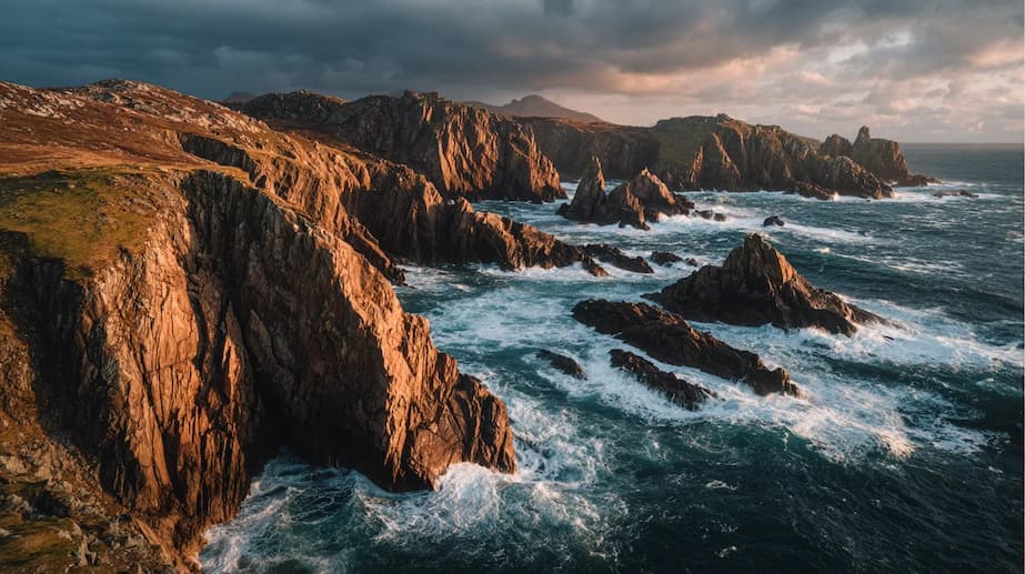
Donegal is the county Irish people themselves name first when asked where the country is still wild. Its coast takes the Wild Atlantic Way to its northern conclusion through mountain gaps and fjord-like inlets, and at Malin Head — Ireland's true north — the land ends in shale cliffs where the word EIRE is still spelled out in stones from wartime neutrality patrols.
This is a long day built for travellers who love landscape over checklists: distances are real, stops are dramatic, and the roads between them are the attraction. The southern gateway is Donegal Town with its O'Donnell castle; the return sweeps through the Barnesmore Gap and past Benbulben's profile into Sligo. Route and quote are tailored to your base through the custom tour form.
Tour highlights
- Malin Head — Ireland's northernmost point and its wartime EIRE sign
- Donegal Town, O'Donnell castle, and the Diamond
- Wild Atlantic Way driving through the Inishowen Peninsula
- Barnesmore Gap through the Bluestack Mountains
- Benbulben and the Sligo coast on the scenic return
Suggested itinerary
Every tour is private, so this outline flexes around your group, the weather, and the day's best light.
- 1
North through the gap
The road into Donegal runs the Barnesmore Gap between the Bluestacks — a proper mountain gateway that announces the county's character immediately.
- 2
Donegal Town
Coffee on the Diamond and a look at O'Donnell's 15th-century castle, restored beside the Eske. The tweed shops here are the real thing if gifts are on the agenda.
- 3
Inishowen Peninsula
The long, beautiful run up Inishowen — Grianán of Aileach's stone ringfort can open the leg with its five-county panorama — through Carndonagh towards the head.
- 4
Malin Head
Banba's Crown, the island's last rock: the Lloyd's signal tower, the EIRE 80 stones, and cliffs full of seabirds with Scotland's islands sometimes visible on the horizon. On epic-sky days it is unforgettable.
- 5
Return by Sligo
The homeward sweep passes Donegal Bay and the flat-topped profile of Benbulben, Yeats country's signature mountain — a last scenic act before the midlands road.
Good to know
- This is the longest mainland day we run after the Causeway tour — expect 12+ hours from midlands bases.
- An overnight version (Letterkenny or Derry hotel) unlocks Fanad Lighthouse and Glenveagh National Park.
- Malin Head is fully exposed — the warmest layer you packed earns its place here.
- Phone coverage fades on Inishowen's north; downloads and playlists sorted before departure.
- Northern Lights are occasionally visible from Malin Head on strong autumn/winter activity — luck required.
Frequently asked questions
Why is Malin Head special?
It is the island's northernmost point — the 'Malin' of the shipping forecast — with wartime lookout ruins, the stone EIRE 80 neutrality sign, and cliffs that face the open North Atlantic. Star Wars filmed here for good reason.
Is one day enough for Donegal?
One day delivers the essence via Inishowen and Malin Head, honestly labelled as a long one. The county rewards two — the overnight version adds Glenveagh Castle, Fanad, and the Slieve League cliffs.
Can the tour start from Derry or Letterkenny?
Yes, and it shortens the day considerably — Inishowen begins on Derry's doorstep. Travellers already touring the north often join the route there.
What is the road quality like?
Good national roads to Donegal, then genuinely rural lanes on Inishowen — narrow, scenic, and exactly why a professional driver transforms this particular day.
Private tour enquiry
Request this tour
Share your dates, starting point, and group size and Sebastian will come back with a tailored itinerary and a clear fixed quote — no payment needed to enquire.